Sheep Mountain (W7M/CL-098) SOTA Activation – Gates of the Mountains Wilderness Area, Montana
7 June 2026
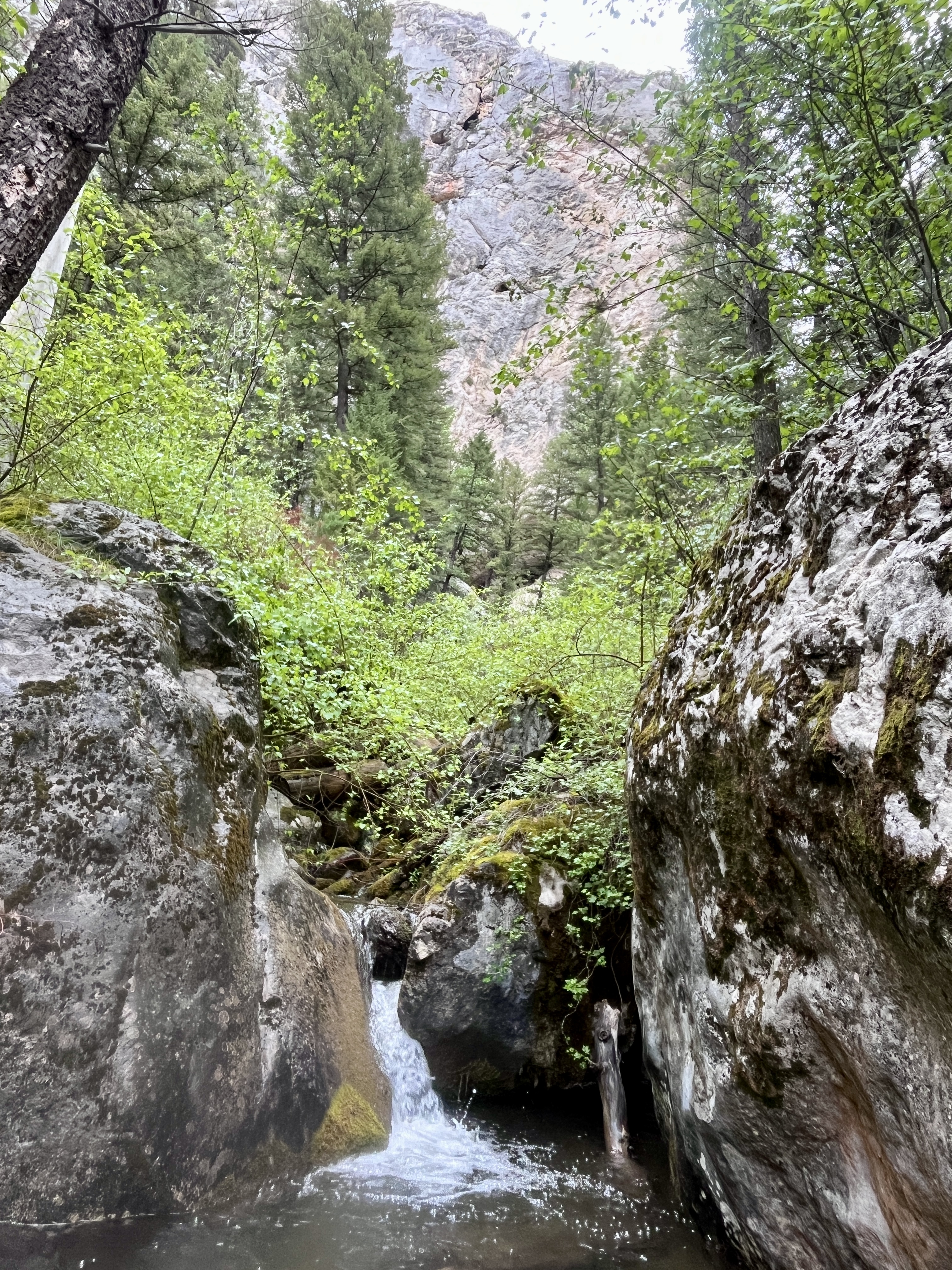
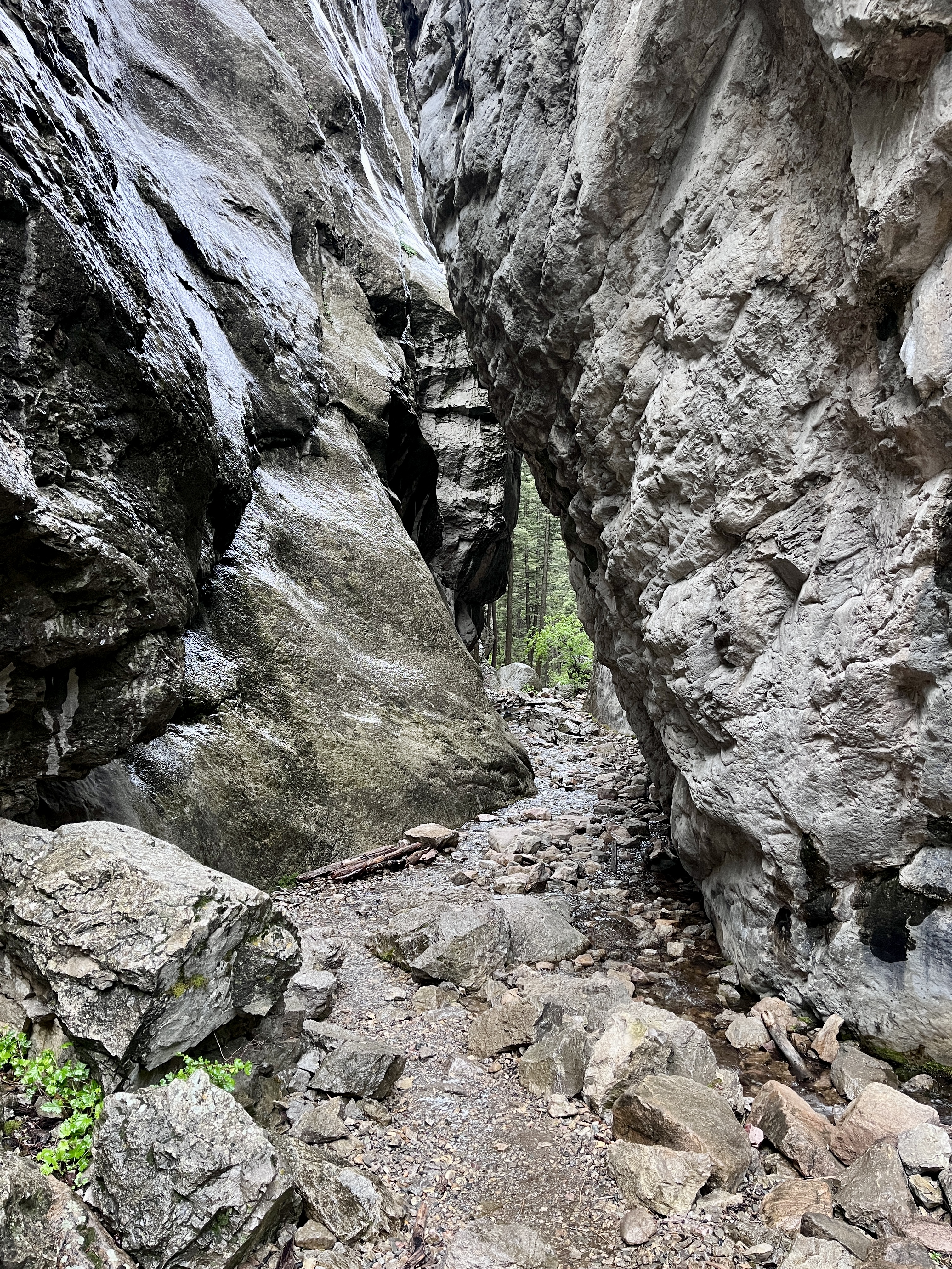
I keep getting drawn back to the Gates of the Mountains Wilderness Area, northeast of Helena. From the Refrigerator Canyon trailhead, you are immersed in a natural wonder of flowing water, lush greenery, and a cool funneling breeze as you approach and pass through the towering canyon walls that squeeze the air through the narrows. The narrows act as a portal to a remote and untouched landscape.
It took me two attempts to reach Moors Mountain (W7M/CL-062) from this route, and it took me two attempts to reach today’s target, Sheep Mountain. The primary reason is the long initial hike up and out of the canyon to reach the other trail system that routes through the wilderness area. For me, that meant a 1-hour, 15-minute hike (2.5 miles) and about 1,200 feet of elevation gain just to get to the starting point for the hike to the summit.
The weather forecast for Sunday’s hike called for cool and wet conditions, with a chance of rain around noon. What I got was rain starting right as I parked at the trailhead at 7 a.m. and began to suit up. I knew this would be a wet hike, so I put on my rain pants and jacket, waterproof boots, and popped my umbrella open as I started on the trail. The temperature was in the low 40s.
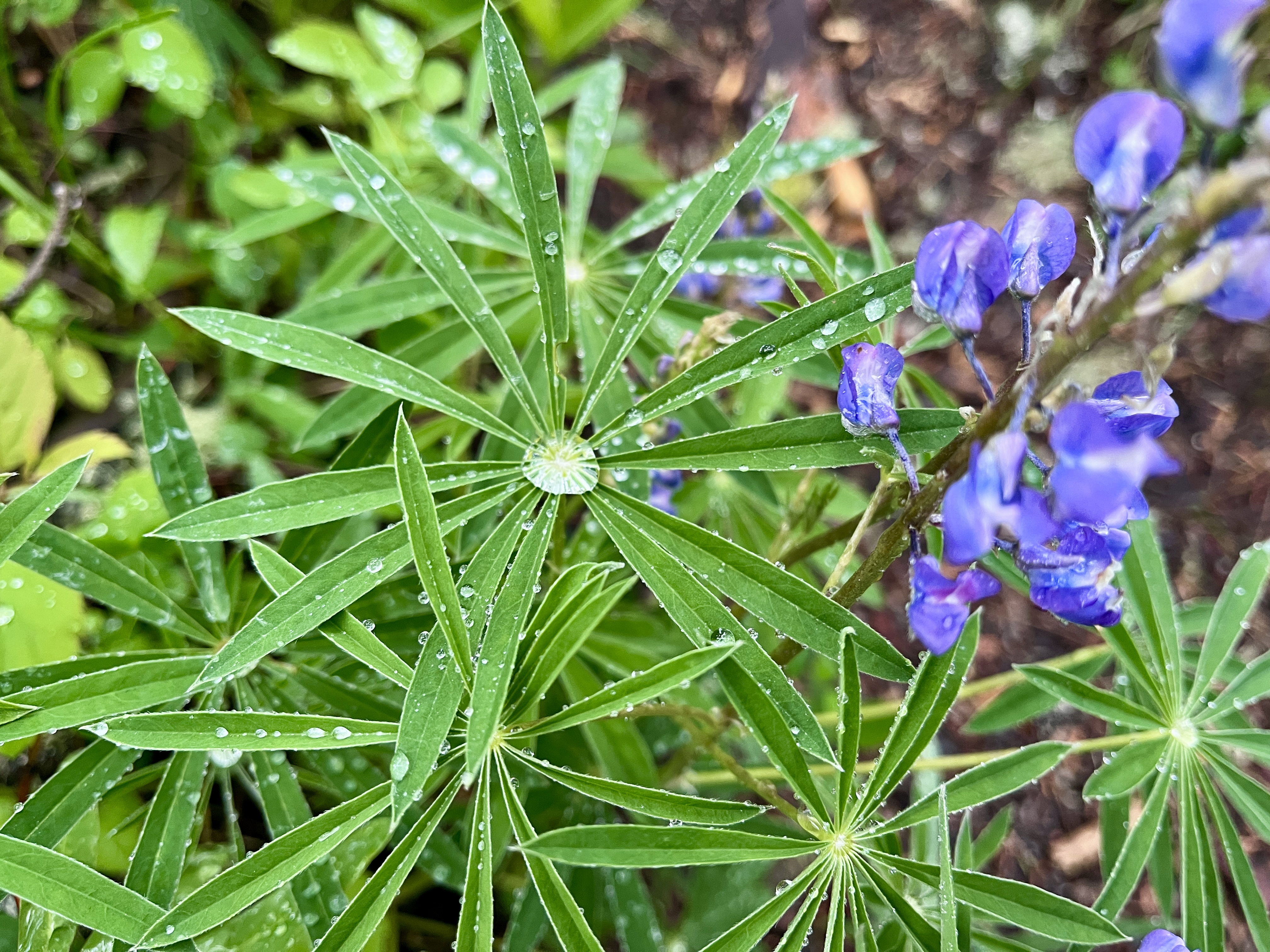
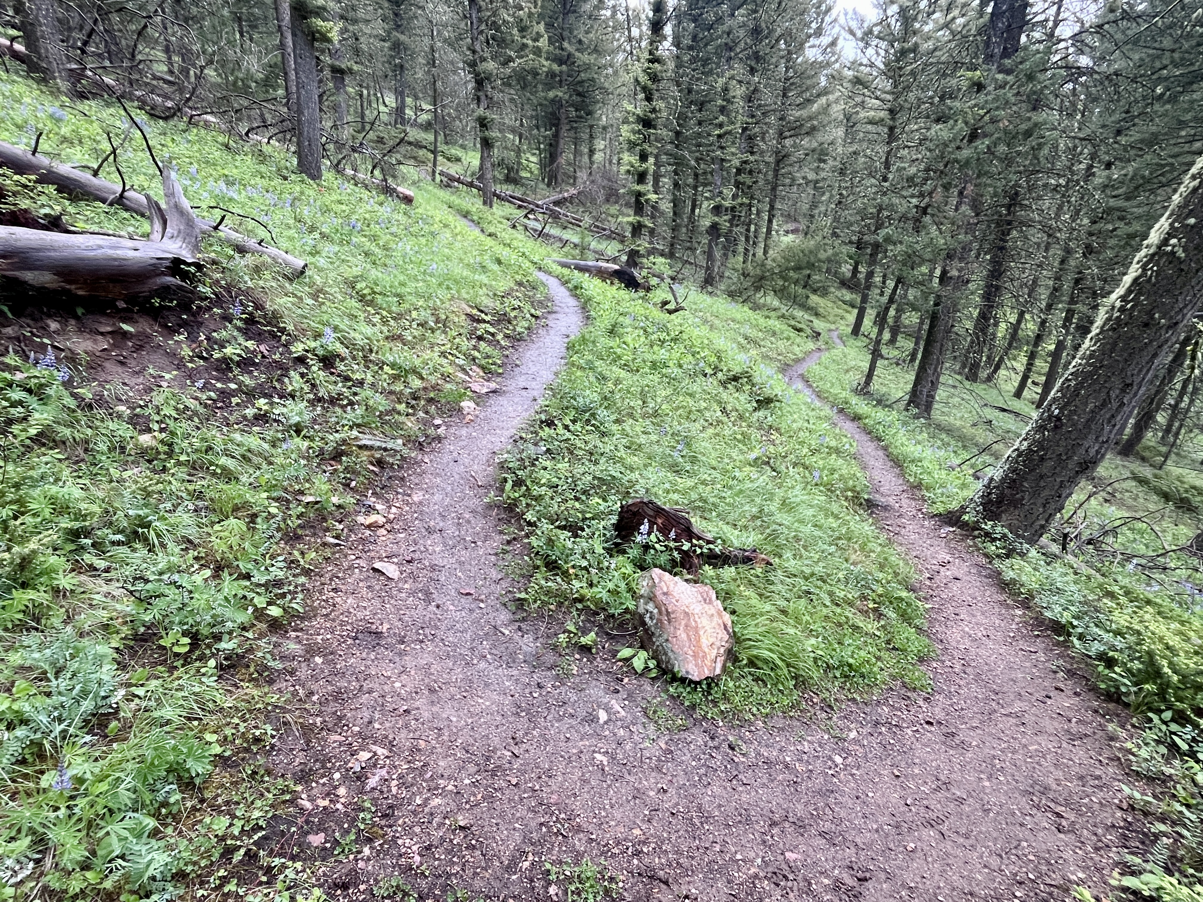
My favorite part of this first section of trail is the stream that you walk up along, then over, and then through, as the trail and stream become intermixed while winding toward the narrows to rock-hop your way through the portal. Then it is up and away from the stream’s basin as you wind north and west into the upper bowl of the watershed. Today’s scenery was drowned in springtime green and highlighted with a carpet of purple-blue flowering lupines.
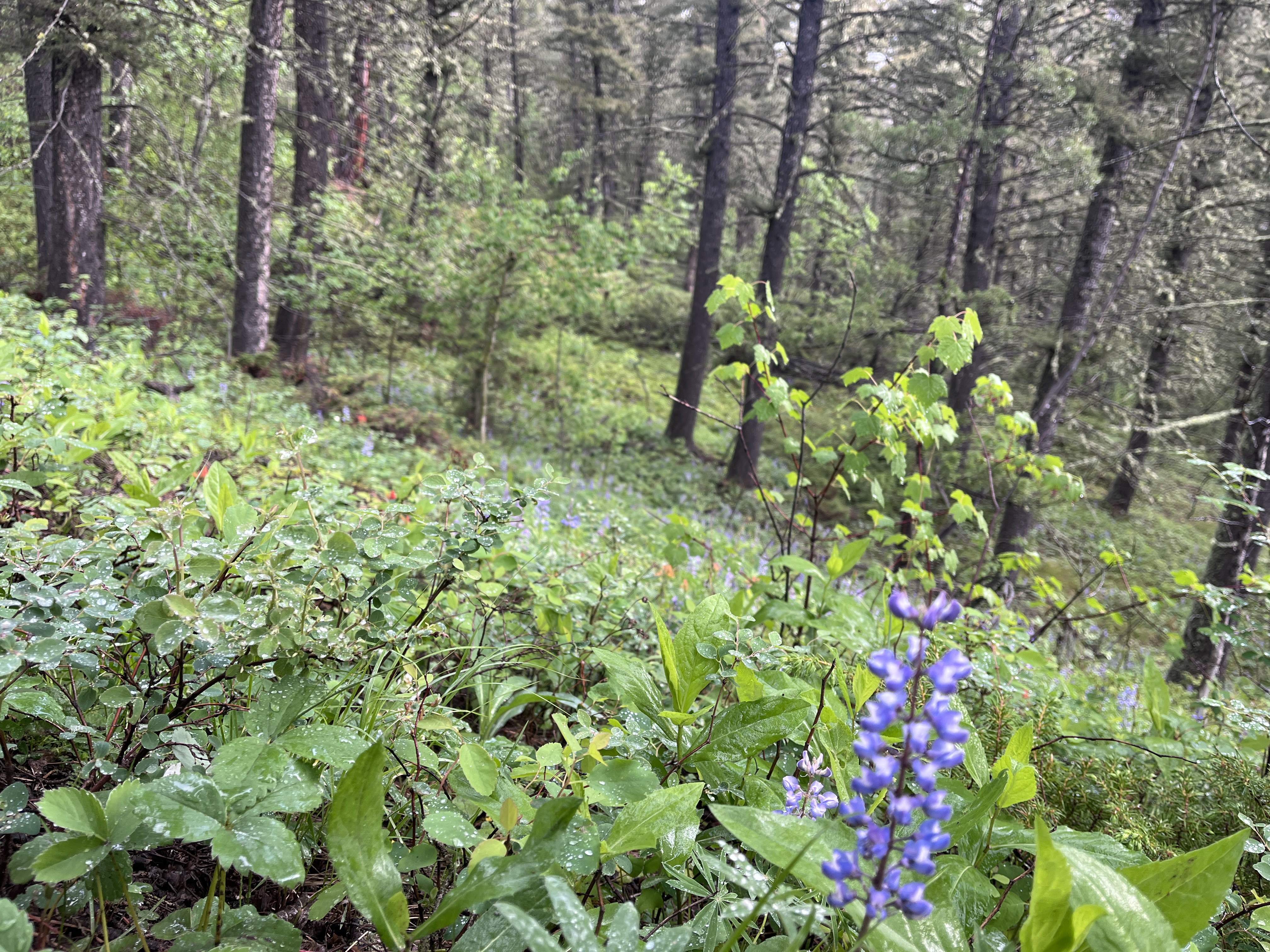
All the plants along the trail were leaning over under the weight of moisture on their leaves. The water droplets acted as little diamonds reflecting the little light from the overcast sky. Fog billowed up from the valley as the wind lifted the moisture up and over the surrounding ridgelines, creating quite a mystical ambiance.
To reach Sheep Mountain there is no official trail. Rather, it entails my favorite kind of hikes—the ones that go off regular trails and encourage you to follow the muted animal paths created over generations of deer and elk winding around their mountainous playground. By the time I reached my takeoff point from the main trail, it had stopped raining. I pointed myself uphill and began zig-zagging upward, using those animal trails as much as I could to gain elevation while remaining mindful of the terrain.
This area is adorned with many sheer rock escarpments that are often obscured while hiking through the forest. I needed to avoid hiking into a draw and getting cliffed out by one of these steep rock faces, forcing a lengthy backtrack. The best route I could gather from the topographic map was an approach from the north-northeast to finish the remaining ~1,500 feet of gain needed to reach the summit.
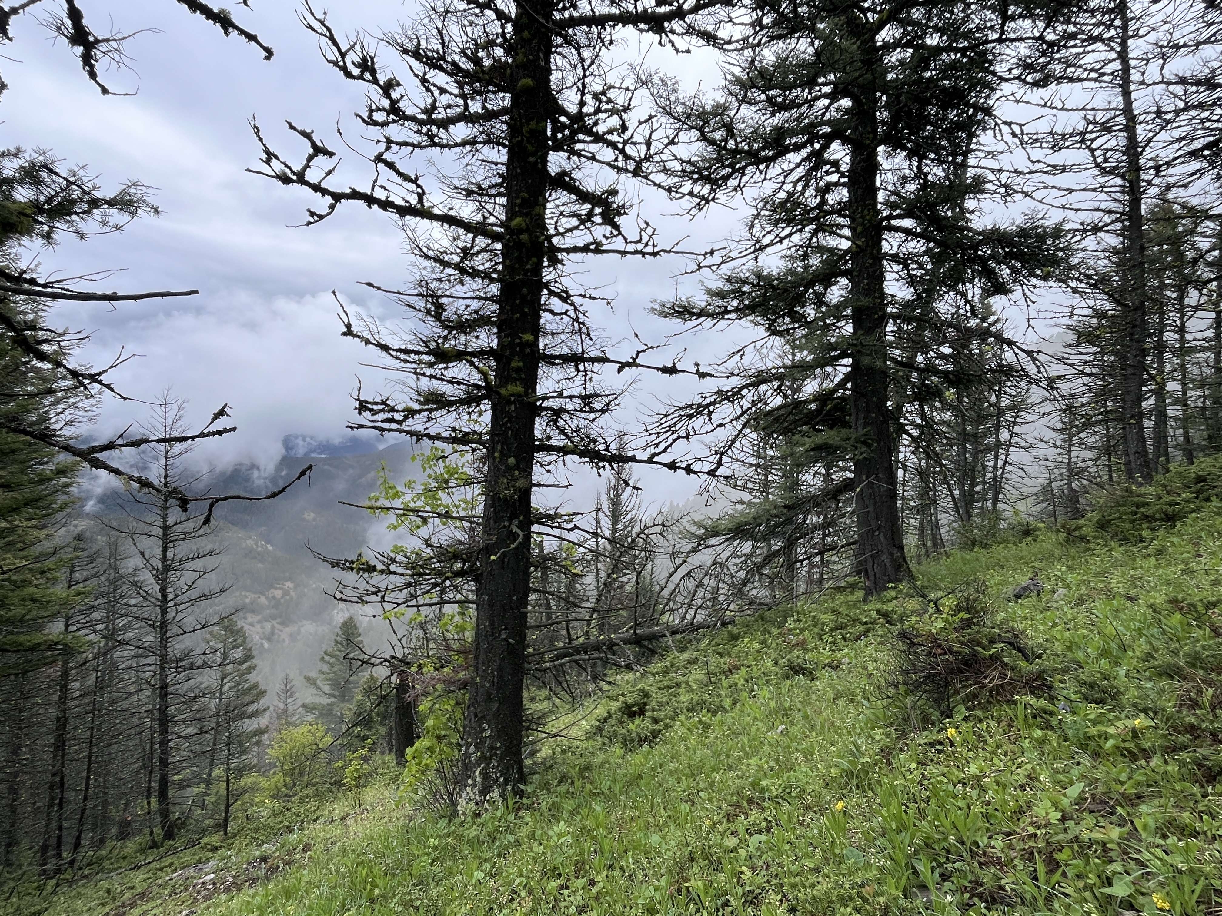
I occasionally checked my phone using the SOTAgoat app to track my elevation gain progress. Each time I felt compelled to find some motivation in that regard, I seemed to have gained about 300 feet. Those 300-foot chunks added up, and eventually the steepness subsided as I neared the summit. As I passed 6,500 feet in elevation, I noticed something odd, but not uncommon for early June in Montana: snow on the ground from the overnight precipitation, just traces of it here and there amongst the gaps in the tree canopy.
Upon arriving at the summit, I was in the clouds and the air was nearly still. I imagined the view on a clear day would be impressive, but not today. I quickly found a nice spot to operate from. My ideal location today was somewhere I could hang my umbrella so I could sit under it if it decided to start raining again.
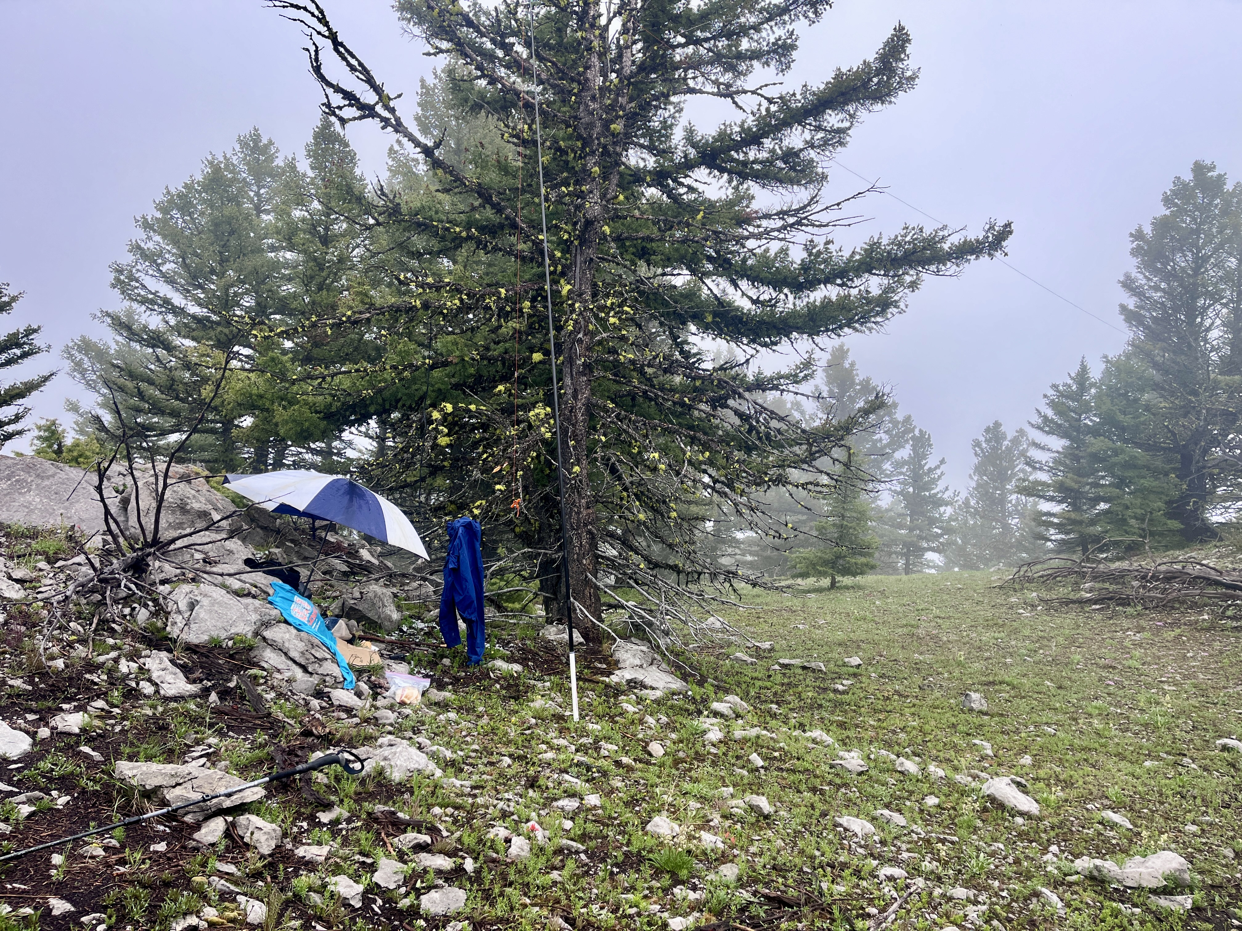
Turns out I didn’t need to worry about rain. As I began to stretch out my EFHW antenna wire, I noticed a few specks of snow pellets falling around the summit. Once tucked in under my umbrella, those pellets picked up and snow began to pile up ever so slightly around my boots that were sticking out from my makeshift shelter.
On 2 meters, Brett (N7SKI) was the first in the log, followed by four more locals to get the summit officially activated—the first time since 2015 when Rob (AE7AP) first activated it. Then I moved over to 40 meters with the MountainTop radio, but only found two friends there. Twenty meters landed 13 contacts, including one S2S and two DX contacts.
As my fingers were starting to get cold and the contacts were ending, I decided to skip trying 30 meters, packed up, and headed back down the ridge. Before long, I was back on the main trail and hoofing the final 2.5 miles back to the trailhead to complete a successful day in the mountains.
Observation of the day: don’t let a rainy day spoil what could be a unique and rewarding experience. Seeing, hearing, and smelling the forest in the rain was absolutely worth the effort.